Pop City MapPlanning | Storytelling
DALLAS, TX
2013-2016
[bc] has always aspired to impact neighborhoods across the state by using design to build capacity and empower communities. Across the country we started to see that neighborhood boundaries in other cities were being codified and illustrated; they were being drawn and debated, they were being mapped and associated with local data. In Dallas, [bc] reasoned that in order to support neighborhoods through our work, we first needed to know what and where the neighborhoods of Dallas were, launching what was then known as the Dallas Neighborhoods Project.
Check out other projects that fall within our POP [People Organizing Place] Initiative here.
Partners:
[bc] Contributors:
Thomas Simpson
Emily Schmidt
Katherine Dike
Lizzie MacWillie
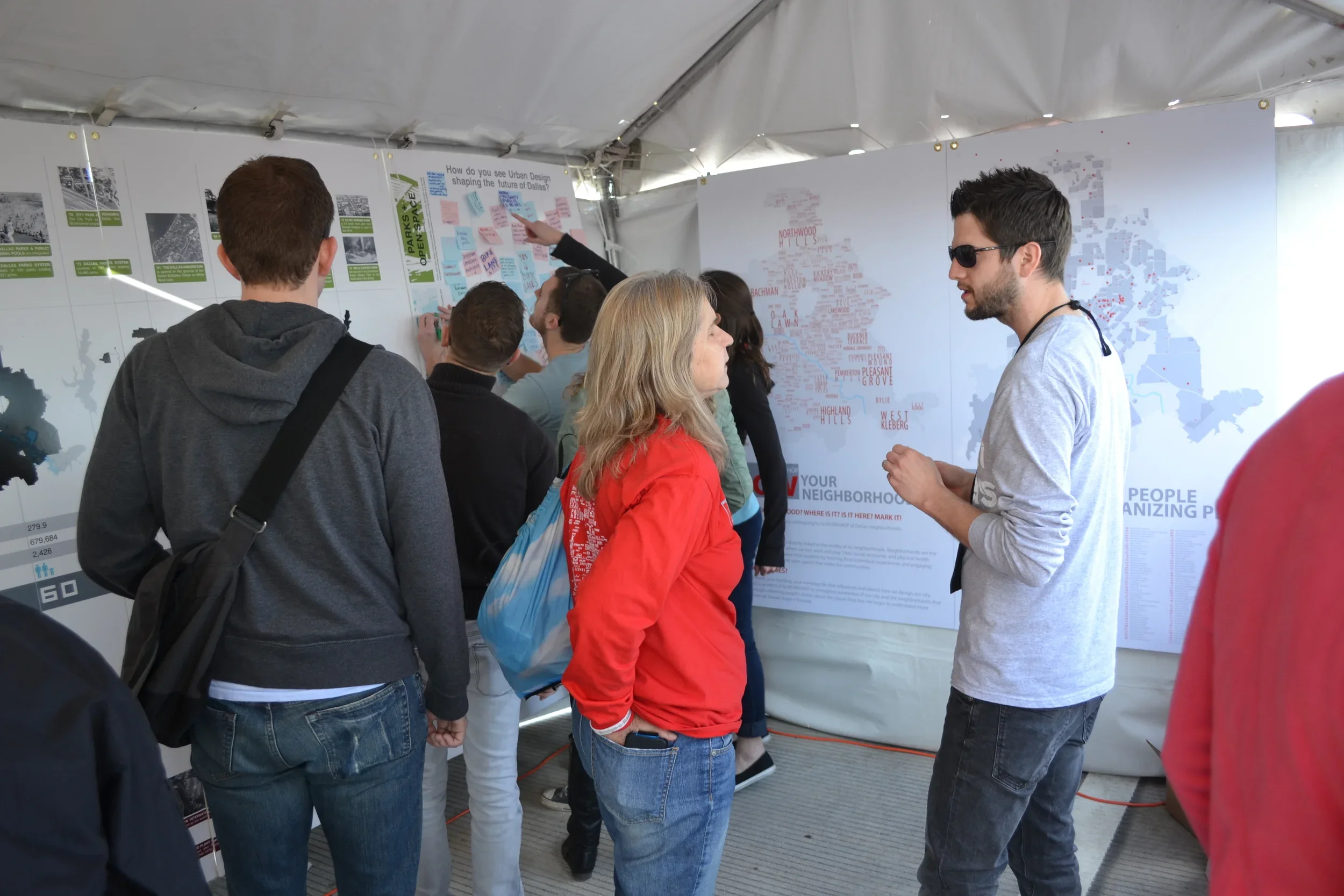
As part of [bc]’s grassroots city planning initiative People Organizing Place [POP], the POP Neighborhood Map project has positioned residents as community experts to assist in identifying boundaries for all definable neighborhoods within the city, creating a framework for a network of neighborhoods with a more accurate perception of culture, identity, and unified values within neighborhoods. Strong neighborhood identities foster community and organize residents to advocate for their neighborhood's future.
To date, through research and community outreach, the project has identified 378 neighborhoods, making it the city’s most comprehensive neighborhood map and filling a void among the city’s existing local resources. The POP Neighborhood Map adds two new tools for strengthening neighborhood identity and geographic definition:
Know Your Neighborhood is a directory of Dallas neighborhood information; visitors can find out about the history, existing neighborhood organizations, statistics about its residents and buildings, and city council information for all neighborhoods mapped by [bc]. Future posts on this blog will discuss the data and analysis that is presented through the directory.
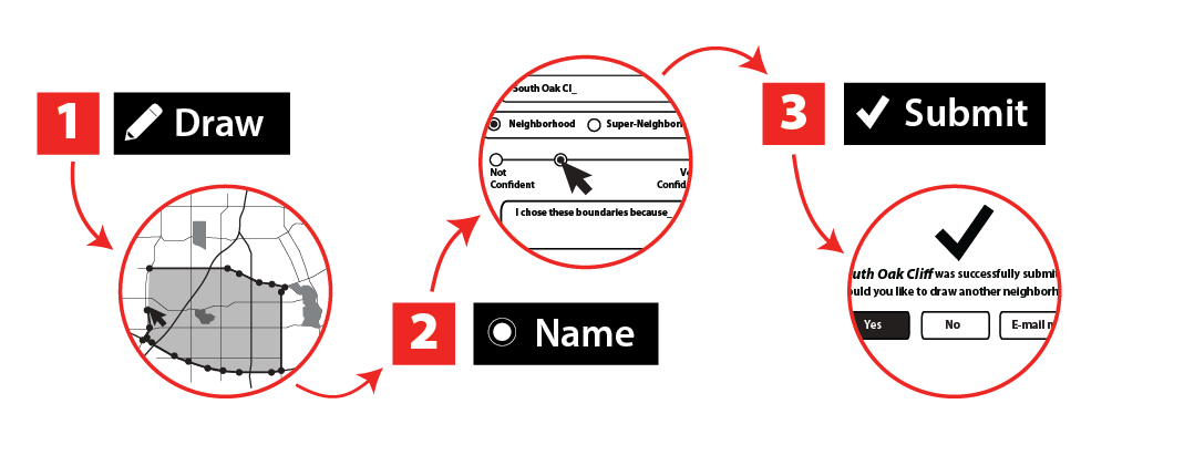
How to "Draw Your Neighborhood"
Draw Your Neighborhood is a digital tool for mapping neighborhoods; users can draw, name and describe their neighborhoods, greatly expanding our ability to crowdsource detailed neighborhood boundaries. Users can also draw super neighborhoods, a new focus of The POP Neighborhood Map project. Super neighborhoods are contiguous groupings of neighborhoods or communities that function as an organizing element to bridge between neighborhoods and larger municipally designated geographies such as service areas or city council districts. We'll give periodic updates on this blog, sharing trends, points of interest, and analysis of the information that folks share with us.
In partnership with Downtown Dallas, Inc. and in conjunction with the launching of the Downtown Dallas 360 Plan, we’ll be starting our Know Your Neighborhood and Draw Your Neighborhood community outreach with a focus on the downtown Dallas area. We will then shift our focus to other large areas of the city, working with community groups and leaders to reach as many people as possible. We’ll continue to engage new regions of the city, working our way across its full geography, until we’ve covered its extents and every neighborhood in the city! Updates on our progress and the exciting discoveries we make along the way will be posted here regularly, so stay tuned, and be sure to draw your neighborhood on the map!
Active and resilient neighborhoods are the foundation of a successful city. POP [People Organizing Place] Dallas is the bcWORKSHOP public design effort to strengthen the social, economic, and physical health of Dallas’s neighborhoods. The POP City Map is a new tool that frames how we naturally organize our communities: as neighborhoods. The City Map builds awareness of our city, celebrates the diverse places that give it character and texture, shares critical data on a local scale, and creates a platform for dialogue about its history and future. Filling a void among the city’s existing local resources, the map will serve as a valuable resource for residents, planners, developers, government and other organizations planning the future of our city. Strengthening the identities of Dallas’s neighborhoods, and lessening the reliance on directional references (e.g., North Dallas), enables Dallasites to reconnect more personally and purposefully with place.
UPDATES
POP Neighborhood Map Update - Modifications to Existing Boundaries!
August 9, 2016
For the past 4 years, buildingcommunityWORKSHOP ([bc]) has been working with residents to create the POP Neighborhood Map, a comprehensive map of Dallas neighborhoods. About a year ago, [bc] put the map online and launched two new digital tools - Know Your Neighborhood and Draw Your Neighborhood - to inform and support neighborhood-based advocacy through the collecting and sharing of neighborhood-specific data - political, geographical, historical, statistical, and organizational information - with Dallas neighborhoods and their residents. Using the Draw Your Neighborhood tool - 226 participants submitted boundaries for neighborhoods across Dallas to be added to the POP Neighborhood Map. Over the next 5 weeks, we’re going to discuss some of those submissions and ask for help in getting more info about the neighborhoods we’ve been hearing about. Through this blog we’ll share: the 4 new neighborhoods we recently added to the POP Neighborhood Map; questions about the boundaries and identities of a few neighborhoods already on the POP Neighborhood Map; neighborhoods that were new to us that we’d like to learn more about; a report on downtown Dallas neighborhoods; and finally, what we’ve learned about “super neighborhoods” in Dallas.
Thank you to everyone that has participated so far, this is an exciting beginning! If you have knowledge or stories that you’d like to share about the neighborhoods discussed here, send us an email. If you’d like to submit your own neighborhood boundaries, visit Draw Your Neighborhood!
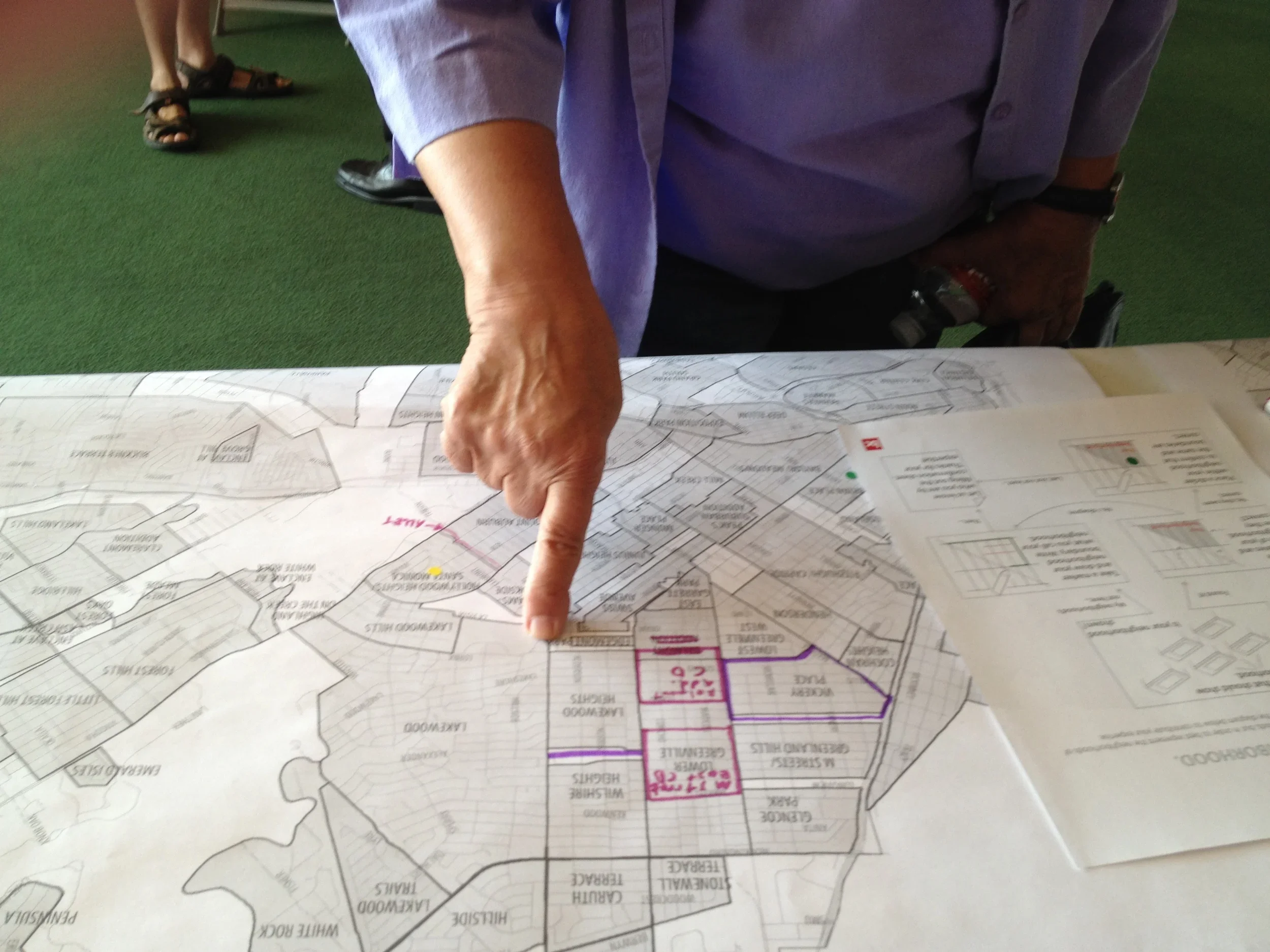
Modifications and Overlaps
Based on input we received via the interactive neighborhood boundary drawing tool Draw Your Neighborhood, [bc] has been considering making some changes to the boundaries of a few neighborhoods - Parkdale, Lake Park Estates, L Streets, Merriman Park/University Manor, and Lake Cliff - already on the POP Neighborhood Map. Borders currently included on the map are shown in blue while suggested new boundaries are shown in red. What do you think about the changes people suggested?
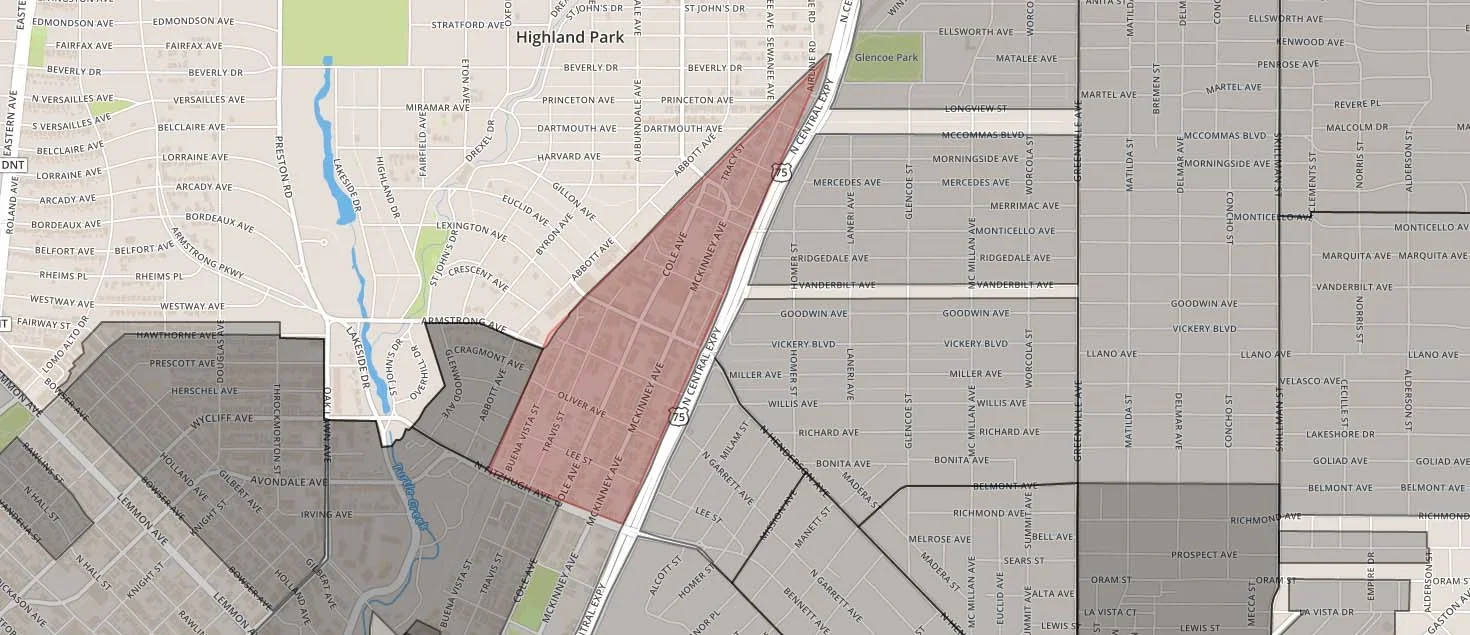
L Streets
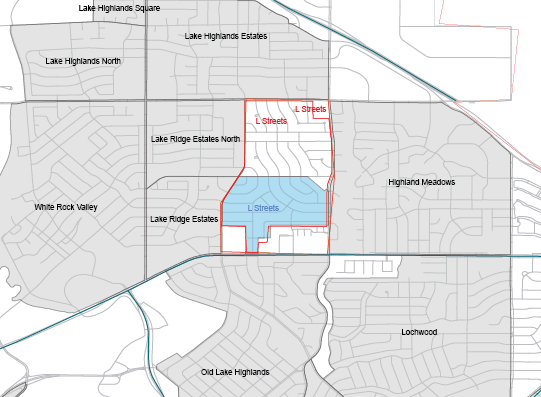
Boundaries for L Streets as drawn on the POP Neighborhood Map and as submitted online
Established in 1954, the L Streets is a neighborhood located just two miles northeast of White Rock Lake. The neighborhood has been on the POP Neighborhood Map for a long time, but we received a few submissions for boundaries different than what is currently drawn on the map. Both suggested boundaries extend the L Streets north to Walnut Hill Lane, and one extends the boundary south to Northwest Highway.
Lake Cliff
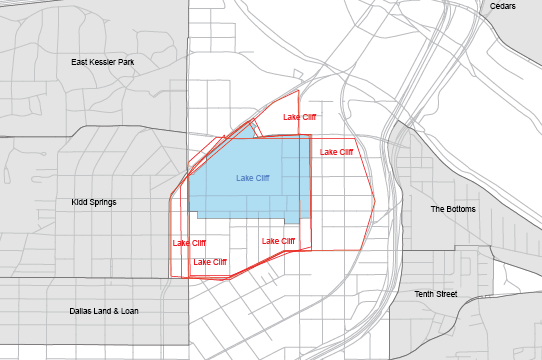

Boundaries for Lake Cliff as drawn on the POP Neighborhood Map and as submitted online
Centered around the lake of the same name, Lake Cliff was the site of Texas’ largest cultural/amusement complex in the early 1900s. Residential development began in 1913 after the complex closed, and the neighborhood is now a historic district. We received five different suggestions of modifications to the Lake Cliff neighborhood boundaries. There appears to be agreement that southern boundary is Davis, but no consensus on the other boundaries. One contributor believes the eastern boundary should be Jefferson, not between Marsalis and Lancaster, as it's currently drawn on the map. The western boundary varies between Beckley and Zang.
Lake Park Estates
Boundaries for Lake Park Estates as drawn on the POP Neighborhood Map and as submitted online
Lake Park Estates is a neighborhood of 288 homes, most dating from the 1950s and ‘60s, located just east of White Rock Lake. Little Ireland was drawn twice with significant overlap with Lake Park Estates.The name “Little Ireland” is new to us. Lake Park Estates was drawn with different boundaries than what we've seen in the past. Do you live in Lake Park Estates or Little Ireland? We’d love to know more about these neighborhoods.
Merriman Park/ University Manor
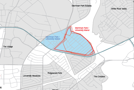
Boundaries for Merriman Park/University Manor as drawn on the POP Neighborhood Map and as submitted online
Merriman Park/University Manor is a neighborhood of single family homes, established 1954, nestled against the upland of White Rock Lake Park. The neighborhood was drawn five times with boundaries different than what we've seen previously.
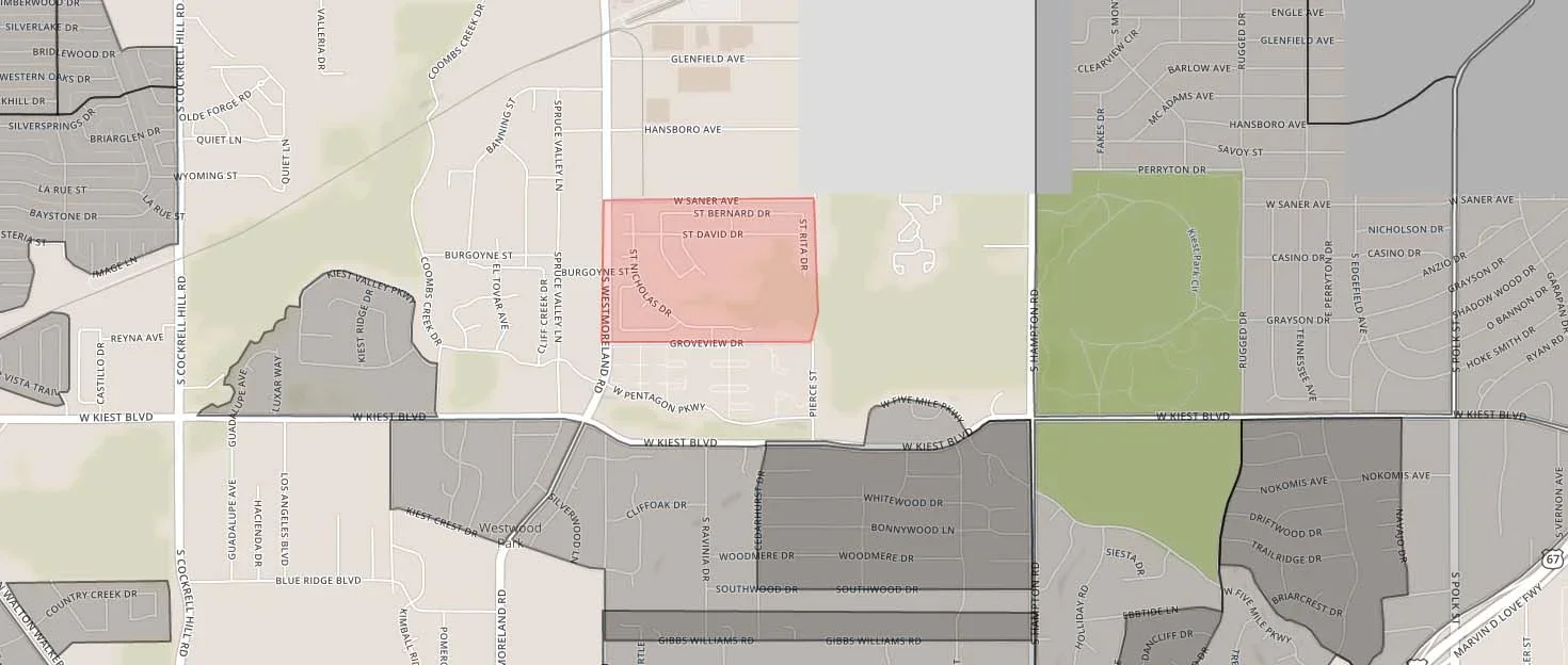
Parkdale

Boundaries for Parkdale as drawn on the POP Neighborhood Map and as submitted online
A number of folks drew a neighborhood called Parkdale Heights that overlapped with what [bc] had recorded as Parkdale. Established in 1926, the Parkdale neighborhood includes about 1,000 homes dating primarily from the 1950s bordering the Great Trinity Forest in southeast Dallas. Is Parkdale Heights a different neighborhood than Parkdale? Should the current boundaries given for Parkdale be modified?
POP Neighborhood Map Update - Additions to the Map!
August 2, 2016
For the past 4 years, buildingcommunityWORKSHOP ([bc]) has been working with residents to create the POP Neighborhood Map, a comprehensive map of Dallas neighborhoods. About a year ago, [bc] put the map online and launched two new digital tools - Know Your Neighborhood and Draw Your Neighborhood - to inform and support neighborhood-based advocacy through the collecting and sharing of neighborhood-specific data - political, geographical, historical, statistical, and organizational information - with Dallas neighborhoods and their residents. Using the Draw Your Neighborhood tool - 226 participants submitted boundaries for neighborhoods across Dallas to be added to the POP Neighborhood Map. Over the next 5 weeks, we’re going to discuss some of those submissions and ask for help in getting more info about the neighborhoods we’ve been hearing about. Through this blog we’ll share: the 4 new neighborhoods we recently added to the POP Neighborhood Map; questions about the boundaries and identities of a few neighborhoods already on the POP Neighborhood Map; neighborhoods that were new to us that we’d like to learn more about; a report on downtown Dallas neighborhoods; and finally, what we’ve learned about “super neighborhoods” in Dallas.
Thank you to everyone that has participated so far, this is an exciting beginning! If you have knowledge or stories that you’d like to share about the neighborhoods discussed here, send us an email. If you’d like to submit your own neighborhood boundaries, visit Draw Your Neighborhood!
Newly Added Neighborhoods
A neighborhood boundary must be drawn the same way 3 times for a new neighborhood to get added to the POP Neighborhood Map. Through citizen participation, we’ve been able to confirm 4 new neighborhoods - Brettonwoods, Capella Park, Encino Hills, and Knox Park. Here are the boundaries of these recent additions and a little bit of information about each of them.
Brettonwoods
Brettonwoods neighborhood boundaries
Prior to the 1950's the place now known as Brettonwoods was farmland and woods nestled along Crow Creek. Much of Brettonwoods was originally part of the Overton Farm. In the early 1950's, the Overton family began to sell tracts of land along the woodlands of Crow Creek and the open farmland to the north of the neighborhood. The winding streets & the towering trees in the southern sector of Oak Cliff is home to a variety of houses built mostly in the 1950's, which include ranches, traditional and mid- century moderns. The Neighborhood started a Nextdoor community in May 2012 and became a Neighborhood Association in September 2014. They hold consistent quarterly meetings and an annually well attended National Night Out event in addition to other neighborhood-based social and service gatherings.
(Source: Brettonwoods Neighborhood Association; POP Neighborhood Map)
Capella Park
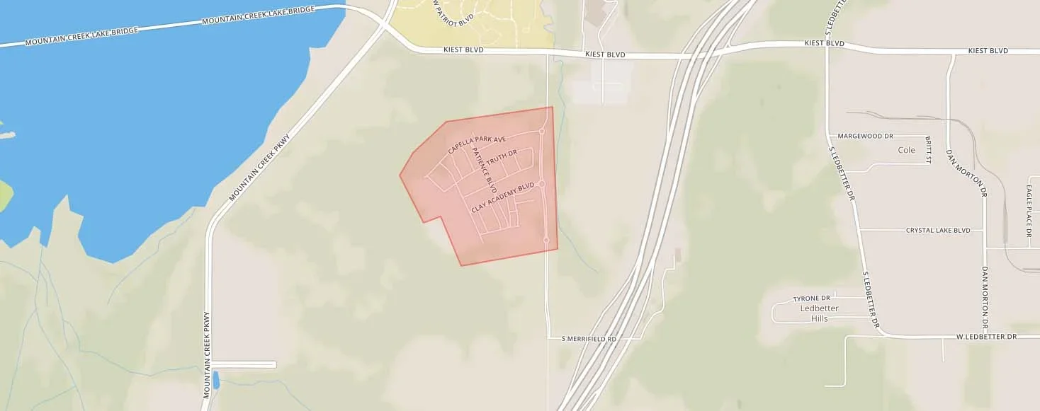
Capella Park neighborhood boundaries
Capella Park is a New Urbanist-inspired subdivision that was developed in the early 2000’s. The neighborhood is proud of its eclectic architecture, rolling hills, and strong sense of community. It is located near Mountain Creek Lake, Dallas Baptist University, and Cedar Hill State Park.
Encino Hills
Encino Hills neighborhood boundaries
Encino Hills is a roomy subdivision developed in the early 2000’s. It enjoys some of the best access to natural beauty in Dallas thanks to its location near the Oak Cliff Nature Preserve and Kiest Park.
Knox Park
Knox Park neighborhood boundaries
Knox Park is a vibrant mixed-use neighborhood bordered by N. Central Expressway and the Katy Trail that is home to an eclectic mix of restaurants, shopping, and residential spaces. Knox Park is only minutes away from downtown.
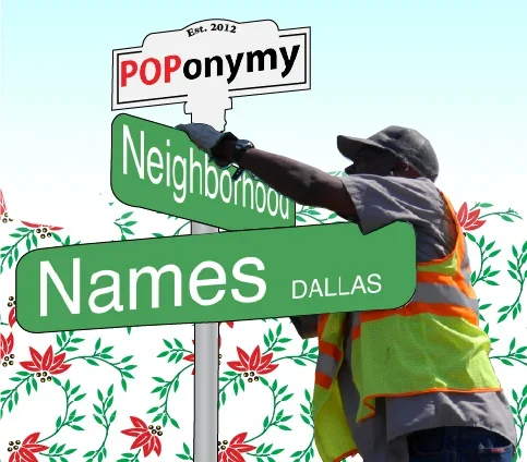
POPonymy - An Interpretive Typology of Dallas Neighborhood Names
November 13, 2015
by Thomas Simpson
American toponymist George R. Stewart clarified in his 1975 book Names on the Globe that “to be named, a place must first be conceived as an entity, that is, as being separable and identifiable from other places.” It seems clear that neighborhoods are entities — they have unique people, parts, and pasts — and yet, in Dallas, we have not done a very good job of recording where and how they are separable and identifiable from other places. They’ve been inadequately mapped. This realization compelled us at buildingcommunityWORKSHOP to initiate the POP neighborhood map, a living document that records and maps the city’s neighborhoods as dictated by its citizens.
As part of [bc]’s grassroots city planning initiative People Organizing Place [POP], over the last three years the POP Neighborhood Map project has positioned residents as community experts to assist in identifying boundaries for all definable neighborhoods within the city, creating a framework for a network of neighborhoods with a more accurate perception of culture, identity, and unified values within neighborhoods. Strong neighborhood identities foster community and organize residents to advocate for their neighborhood's future.
The POP neighborhood map has two major components: boundaries and names. In the past, [bc] has stressed the importance of the edges and borders and territory of the neighborhood map, but we don’t want to do so at the expense of our local toponymy (from Greek, meaning “place name”). As important as it is to demarcate the entity by drawing neighborhood boundaries is to give it a name.
Dallas neighborhood names speak volumes about the city’s complexion. Just as our words offer insight into our character, the way the city describes itself and names its parts- its toponymy- offer insight into its anatomy, its aspirations, its values, and its history. Rather than a study of the origin of individual place names, this is a typology of toponymy, revealing the city’s values through categories of place names. Neighborhoods are the building blocks of cities; what information can we elicit about the city collectively from the kind of names it gives it components?
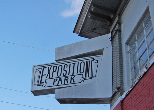
Exposition Park is named for the adjacent Fair Park, in particular, 1936's Texas Centennial Exposition
Dallas has a complex relationship with history and memory. We’re conflicted about how to remember a legacy of violence and hate; insecure about our humble beginnings absent revolution or war. But we’re inspired by our youth and a twentieth century motive of progress through production, growth, and, frequently, reinvention. Still, Dallas history is embedded in the names of its oldest neighborhoods in one way or another. In some cases, history is encoded in both the name and the built environment. Colonel Jefferson Peak’s family has two neighborhoods of turn-of-the-century structures that remind us of their role in developing East Dallas: Peak’s Suburban Addition and Junius Heights, named for one of the Colonel’s sons. Other times, physical history has been destroyed while a name and legacy remain. The Mill City neighborhood marks the spot of a historically black neighborhood intertwined with a black-owned and operated twine mill. Dallas’ voracious growth also swallows history, leaving a vestigial name. A number of neighborhoods recall farming villages that were annexed into the quickly sprawling city: Vickery Meadow (for the town Vickery), Fruitdale, Lisbon, Rylie, Kleberg.
The city gets definition from its natural environment (yes, even Dallas) and our relationship to natural features is inscribed in neighborhood names. The major natural (although much altered) feature in Dallas is the Trinity River, and the river, its fingers, and their reservoirs have deeply influenced the city’s toponymic language. Despite this city’s (and most others, besides Venice) proclivity to entomb our water, Dallas has managed to retain some hydrological identification. Of the 375 neighborhoods [bc] has counted, twelve have “Creek” in their name and sixteen include the word “Lake.” Two even include the word “Spring.” How might a relationship to water less reliant on culverts and ditches and levees alter our naming conventions?
One of the most pervasive refrains about Dallas, written by historian Herbert Gambrell, declares that Dallas is a city “that man has made, with a little help from nature and practically none from Providence.” At its core, Dallas has always been a city about business, and man-made enterprise that has shaped Dallas has also imprinted itself in our vocabulary: Love Field, Southwestern Medical District, Design District, Dallas Arts District. The image of a steel and concrete Dallas emerging from an idle plain is surely reflected in the neighborhoods named for physical works and infrastructure: Tenth Street Historic District, Kings Highway, or the M Streets and L Streets. People are capable of creating more than physical things, though; another Dallas historian, A.C. Greene, told us that Dallas was an “imaginary city.” Many Dallas neighborhood names use words for physical places as part of an act of projection, association, and image construction such as the Disney Streets, or one of the 20 neighborhoods with “Park” in their name and no park in their territory.
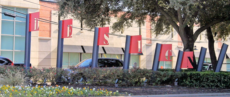
Design District evolved from warehouses, to design and antique showrooms, to a multi-use neighborhood that retains design at its heart
Topography is key to toponymy, and the shape of the land shapes our place names. Whether a result of its relatively limited topographic variation or because that variation is so important in a floodplain, Dallas is full of “Hills,” “Heights,” and “Highlands.” Do these neighborhoods really reflect topography, or are they real estate sleights of hand? Let’s assume that Highlands refer to places of a consistently raised elevation, Hills are places with greater variety of elevation, and that Heights are peaks. Digging into the data, the average “Highlands” neighborhood is perched 80 feet higher than the city as a whole. Elevation in the “Hills” neighborhoods varies an average of 45 feet while the average for all neighborhoods is 37 feet. “Heights” neighborhoods, perhaps, are more deceiving, on average reaching a maximum elevation of 541 feet, versus 562 for all neighborhoods. Perhaps they are “Heights” relative to their surroundings. So, if you are looking to find interruptions to the prairie, feel free to rely on the neighborhood name...some of the time.
More important than whether neighborhood names about topography are accurate are what they convey to us. How does topography segregate the city by race and income? Heights and Highlands would indicate less of a flood risk. Unsurprisingly, two enduring place names, the historically black The Bottom in Oak Cliff and immigrant Hispanic La Bajada (“the descent”) in West Dallas, have this pernicious legacy of segregation and environmental injustice baked into their identity. Highland Park’s status is reinforced by our association with the high ground, the defensible position, as superior.
Words that appear most frequently in Dallas neighborhood names
Comparing the average square footage of homes in "estates" neighborhoods
Many neighborhood names betray how aspirational (and frequently emulative) we are as a city. We borrow Winnetka Heights from Chicago and Hollywood/Santa Monica and Beverly Hills from Los Angeles. Dallas’s aspirational quality reveals itself elsewhere, too, seeking perfection (Ideal), joy (Jubilee Park), and togetherness (Unity Estates).
Unfortunately, Dallas is often decried as placeless, an accusation reinforced by its many neighborhood names that pop up on maps all over the country: Lakewood, Ridgewood Park, Hillside, Lake Forest. Are their name-fellows in California, or Illinois, or New Jersey placeless, too? Perhaps these names reflect a desire for homogeneity, or, like brands, generate a comfortably consistent image, a common American ideal, not unlike the aforementioned aspirational neighborhood names, in this case: suburbia.
Notably, Spanish language names are scarcely represented in Dallas neighborhoods- certainly, as in other facets and institutions of the city, not at the rate that Hispanic life exists in the city. Depending on how lenient you are about what constitutes the Spanish language (does Cedar Vista count?) Spanish language neighborhood names account for roughly 5% of the total in a city with over 40% Hispanic residents as of 2010. How should these changing demographics alter the vocabulary of our social landscape?
In a city as young as Dallas we are constantly trying on new names and looks for our places, only sometimes finding something that endures. Little Mexico becomes Victory Park. Bishop Arts and Trinity Groves come to command our civic tongue. Gastonwood and Coronado Hills act as a dual name, then the C Streets is tried on, and eventually an East Dallas neighborhood settles on Lakewood Hills. As we continue to rename, we, as a public, should ensure that our names fit us and fit what we want our city to be, whether that’s a city full of nature, of highs and lows, of consistency, of industries, of mansions or a reflection of our past and of our dreams. What does your neighborhood name mean to you, or to your city?
Names, like all words, are signs. They have history, lineage, and agreed upon relational meanings, but they mean something different to the people who use them to describe themselves or loved ones or loved places. We owe it to our neighbors to know the names of their places. Why refer to the mechanical and anonymous “Southern Sector” when we can invoke the proud and beautiful Wheatley Place, Ravinia Heights, or Pemberton Hill?
If you don’t know what your neighborhood is, want to learn more about Dallas neighborhoods, or are a neighborhood whiz that wants to share your expertise, buildingcommunityWorkshop has developed tools for you. Know Your Neighborhood is a digital directory of Dallas neighborhoods that shares information on neighborhood groups, development history, demographic and land use information, and personal stories from residents and neighbors. Draw Your Neighborhood is an interactive tool that asks participants to share neighborhood names and boundaries as they recognize them through an interactive web-map. In addition, Draw Your Neighborhood solicits “super neighborhood” boundaries, to crowd-source an understanding of how Dallasites aggregate neighborhoods into larger contiguous geographies, such as Old East Dallas or North Oak Cliff. Go use these tools today at www.PeopleOrganizingPlace.com

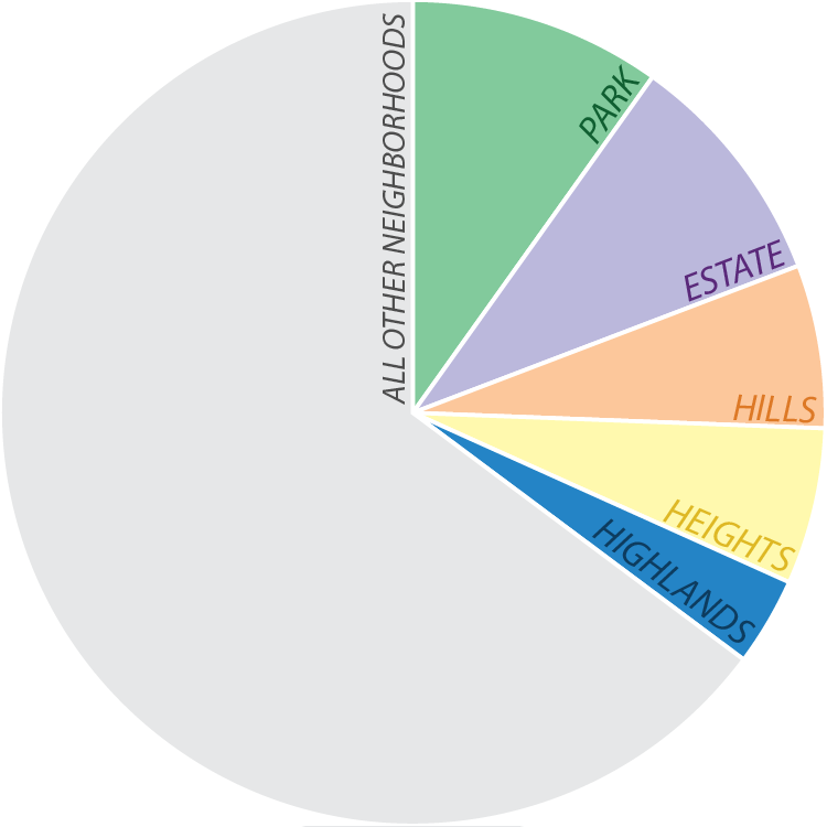
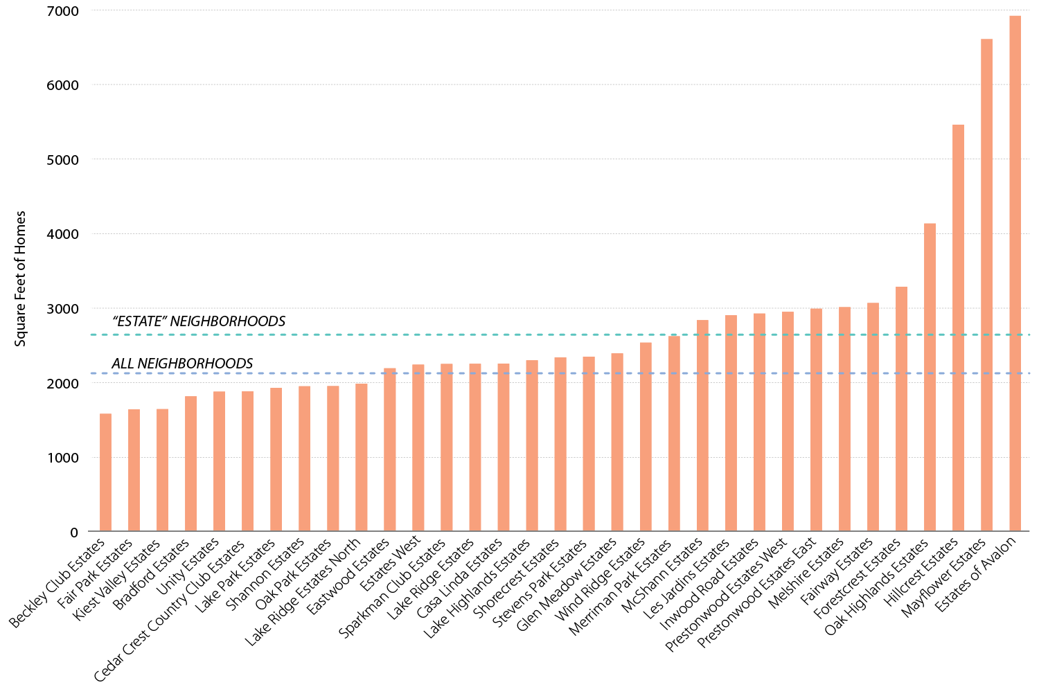
Status finds its way into toponymy beyond topography. Frequently wealthy, successful, or desirable neighborhoods lend their names to — or have them appropriated by — surrounding geographies. There are four Kessler neighborhoods, four Lakewood neighborhoods, and five Prestonwoods. Neighborhoods also distinguish their status descriptively: there are Estates, Acres, Clubs, a Manor. For the most part these names reflect reality. Even though of the 35 neighborhoods with Estates in their name, ten have a smaller average home size than other identified neighborhoods, the overall average home is 2,600 square feet in Estate neighborhoods versus 2,100 square feet on average citywide. The emphasis on home size and, by proxy, status, is characteristically Dallas. In New York, two percent of neighborhoods have “Estate,” “Acre,” “Manor,” or “Club” in their names, the same as Austin. In Chicago, it’s zero. In Atlanta, six percent. In Big D, 12 percent of neighborhood names include one of those four words.
Names might be given to try to exude not just socio-economic status, but other qualities of a community’s inner-life or relationship with the outside world, such as isolation and solitude: The Cloisters; or a nostalgic togetherness: Greenleaf Village, White Rock Village, Stevens Park Village, The Village; or separateness: Enclave at Grove Hill, Enclave at Ash Creek, Enclave at White Rock.
How Large are Homes in "Estates" Neighborhoods?
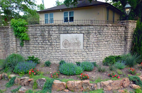
The Cloisters is a neighborhood of mansions on the northwest shores of White Rock Lake
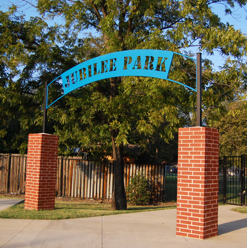
Jubilee Park, in East Dallas near Fair Park, is announced by this metal and brick archway.
And for fun, some favorite Dallas neighborhood names:
Deep Ellum
Moss Farm
Elderwood
La L’aceate
Club Manor
Cedars
La Bajada and Los Altos/The Bottom and the Heights
Queen City
Bonton
Cadillac Heights
Cigarette Hill
Dolphin Heights
Disney Streets
Elm Thicket [North Park]
Jan Mar
Lobello
Love Field
Peak’s Suburban Addition
Turtle Creek
Urbandale
Woods-Sugarberry
Wisdom Terrace
The History of the POP Neighborhood Map
August 14, 2015
[bc] has always aspired to impact neighborhoods across the state by using design to build capacity and empower communities. Across the country we started to see that neighborhood boundaries in other cities were being codified and illustrated; they were being drawn and debated, they were being mapped and associated with local data. In Dallas, [bc] reasoned that in order to support neighborhoods through our work, we first needed to know what and where the neighborhoods of Dallas were, launching what was then known as the Dallas Neighborhoods Project.
Beginning in fall 2011, [bc] conducted extensive research of publicly available resources. Archival material from major publications, municipal boundaries such as planned development districts and landmark districts, neighborhood, homeowners and crime watch groups, were all consulted and reviewed for inclusion in the POP Neighborhood Map. Neighborhoods were added to the map when there was boundary agreement among at least two sources. Into 2012, the map grew incrementally and the extent of nuance to Dallas’s social geography came into focus. The city was no longer East Dallas, North Dallas, West Dallas, and so forth - it was Munger Place and Casa Linda Forest; Melshire Estates and Chapel Downs; Ledbetter and Los Altos. Not to mention Elmwood and Wheatley Place and Urbandale.
The POP Neighborhood Map at the opening of the Margaret Hunt Hill Bridge, 2012
Checking out neighborhood boundaries at the Dallas Homeowners League Boot Camp, 2012
After exhausting publicly available information, we began the “POP map road show” to share our findings and ask citizen experts to tell us where we were right, where we were wrong, and what we had missed. The first public display of the map was at the opening of the Margaret Hunt Hill Bridge, voicing anew the central role of neighborhoods in defining our city amidst parades of giants and a Lyle Lovett concert.
From that auspicious beginning, we took the map to neighborhood meetings, the Dallas Homeowners League Boot Camp, and civic events across the city. Lines were moved from street centerline to alley; “addition” was subtracted from the name Belmont Addition; and dozens of new neighborhoods took shape, emerging from development, history and engagement.
Although it became an end unto itself, the purpose of the neighborhood mapping mission was still to produce tools and develop programs for neighborhood enhancement and empowerment. POP Neighborhood Stories was piloted in six neighborhoods across the city: La Bajada, Tenth Street, Wynnewood North, Dolphin Heights, Mount Auburn, and The Arts District, celebrating each place’s local heritage, assets, and value to the city as a whole; and sharing the historical forces, events and people that shaped each community. We began Activating Vacancy in Tenth Street, employing art and design to activate under-utilized public spaces and position neighborhoods as cultural generators. The Public Agenda broke down barriers to accessing vital municipal decision-making by mapping Dallas City Council agenda items by neighborhood. These tools and more have contributed to a paradigm shift in how the city is conceived, where neighborhoods are the key.
[bc] will continue to develop and share these tools, including Know Your Neighborhood, a digital directory of Dallas neighborhoods that shares information on neighborhood groups, development history, demographic and land use information, as well as personal stories from residents and neighbors. The other half of [bc]’s new POP digital programs is the extension and continuation of [bc]’s previous mapping efforts. Draw Your Neighborhood is an interactive tool that resembles [bc]’s engagement activities, asking participants to share neighborhood names and boundaries as they recognize them through an interactive web-map. In addition, Draw Your Neighborhood solicits “super neighborhood” boundaries, to crowd-source an understanding of how Dallasites aggregate neighborhoods into larger contiguous geographies.
For the POP Neighborhood Map to be successful it must be generated by and resonate with citizens. Its fundamental question is: how do Dallasites define the places that they live, work, and play? This question can only be answered for a given moment - and then necessarily changes with the dynamic city. One change in Dallas since the inception of the POP program has been the growing vocalization of neighborhoods - from elected officials, city staff, entrepreneurs, activists, developers - all across the city. [bc] would like to believe that POP has helped position citizens as leaders in this conversation, push a neighborhood-centric agenda for municipal planning and decision-making, and deepen Dallas’s appreciation for its complex and exciting local geography.
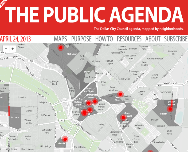
Dallas Public Agenda
April 19, 2013
As part of our POP [People Organizing Place] initiative, bcWORKSHOP announces the launch of The Public Agenda, a digital tool that maps the voting agenda of the Dallas City Council by neighborhoods.
Under a council-manager form of government, the City Council is responsible for the legislative function of the city, including establishing policy, passing local ordinances, voting appropriations, and developing an overall vision. In Dallas, the Council convenes on the second and fourth Wednesday of each month to consider action on the voting agenda.
The Public Agenda uses the POP City Map as a framework for understanding the geography of the decisions that come before the Council. By reformatting the published Council agenda, bcWORKSHOP hopes to enhance opportunities for citizen engagement. Healthy and vibrant neighborhoods are the foundation of a successful city, and every citizen should be empowered as a neighborhood and city advocate.
In announcing the launch of an Open Data Portal this fall, the City of Dallas has issued a Press Release that includes The Public Agenda as an example of products that can be created with open access to data.